

A Guide to Banff Hiking Trails for Conference Attendees
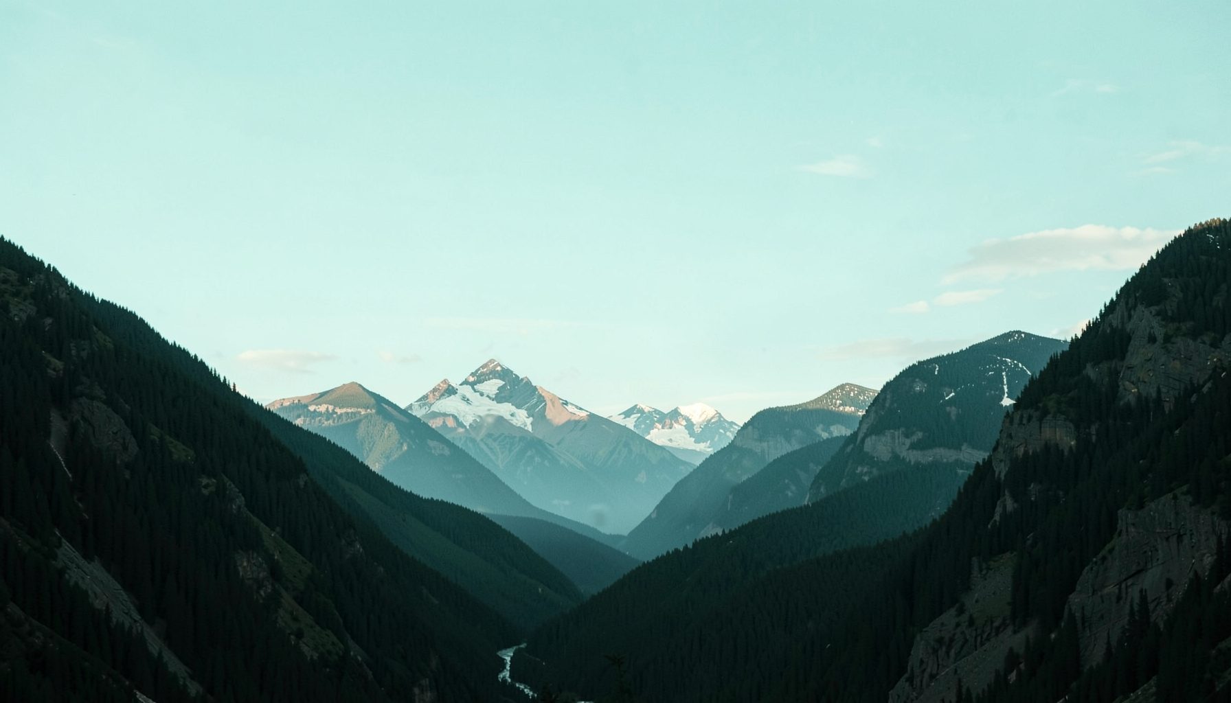
For delegates attending the 2014 Annual Scientific Meeting of the Canadian Organization of Medical Physicists in Banff, the town’s trails offer more than a change of scenery after sessions. This guide to Banff hiking trails for conference attendees focuses on routes that fit around presentations, examinations and business meetings while revealing Banff’s river valleys, forests and mountain ridges.
Australians already navigate by kilometres rather than miles, but Alberta weather can change rapidly, and Banff’s elevation of about 1,400 metres may make the first climb feel stronger than expected. The mountains may resemble the Blue Mountains near Sydney at a glance, yet snowfields, wildlife and creek crossings create conditions quite different from a typical Australian bushwalk.
Matching a trail to your meeting schedule
Start by downloading the scientific program and marking the periods available for exercise. A short riverside route can fill a 60-minute break, while an alpine trail usually needs an entire day. Keeping the scientific sessions visible in your itinerary prevents an ambitious walk from creating the same scheduling pressure as an overdue abstract.
Most visitors describe trails as easy, moderate or strenuous, but distance alone gives an incomplete picture. An 8-kilometre route with a gentle gradient may suit a delegate wanting a long outing, while a shorter ascent with 500 metres of elevation gain may require considerably more effort. Ask about the return distance, the steepest section and whether the route is an out-and-back.
Australian trail language is familiar, although Canadians often use “out-and-back” for a route that follows the same path in both directions. An Australian might call a gentle afternoon outing an “arvo walk”, but Banff trail signs measure the complete circuit or there-and-back journey. Keep the quoted distance in mind rather than estimating the return from the map.
Short walks near Banff town
The Bow River Loop beside Bow Falls is the most convenient option for delegates with limited time. The well-used path is roughly 3 kilometres, takes about an hour and passes viewpoints, bridges and river habitat close to central Banff. It is suitable for anyone who wants movement rather than a serious workout, although paths near the water can become slippery after rain or snowmelt.
Mount Bullen offers a stronger walk without leaving town. Its return distance is approximately 4.5 kilometres, with around 230 metres of elevation gain, and a staircase provides a reliable workout before the wooded upper section. Tunnel Mountain is another good choice at roughly 5.8 kilometres return and 320 metres of climbing. The tunnel itself is a memorable feature, but the final exposed ridge can feel cold even on a mild afternoon.
For a quieter outing, Consolation Lakes combines an easy 5-kilometre return with mountain reflections and several small beaches. These are practical choices for the day before the meeting or after a busy final session. Wear shoes with dependable grip, carry water and avoid treating a short route as suitable for trail running if ice or deep snow remains.
Summit walks with a manageable climb
Sulphur Mountain is the best-known summit close to Banff. The steep route is about 5 kilometres return and gains roughly 557 metres, normally requiring two to three hours. A boardwalk protects the summit terrain while rewarding walkers with broad views over the Bow Valley and nearby peaks. It can be exposed to strong wind, so a warm layer belongs in the pack even when the town feels warm.
Cascade Mountain provides a varied alternative. Hikers can turn back at the lower cascade after roughly 10.6 kilometres return, while continuing toward the upper cascade adds distance, elevation and potentially snow-covered ground. The lower trail still gains about 400 metres and gives a strong sense of the Rockies without requiring the full alpine itinerary.
Both routes call for sensible pacing. Medical physicists may be used to long shifts, but altitude, unfamiliar terrain and low temperatures affect people differently. Start slowly, drink regularly and leave enough time to descend before a scheduled meeting. If there is no reliable daylight buffer, choose Sulphur Mountain’s shorter summit route or save the climb for a free day.
Alpine routes worth a full day
Lake Minnewanka is the easiest major outing for a full day away from the conference. The lake circuit runs approximately 14 to 15 kilometres around the shoreline and usually takes two to three hours, depending on pauses and the weather. It offers open water, forest and mountain scenery without a major climb, making it useful for delegates who want distance rather than altitude.
For a rewarding Canadian Rockies day, the Plain of Six Glaciers trail from Lake Louise is more demanding. The return journey is about 14 kilometres with around 420 metres of gain, and the exposed basin can deliver dramatic views of glaciers and turquoise water. Moraine Lake is another classic destination, with a well-known 3.2-kilometre walk from the lakeshore to the viewpoint; each return journey takes around two to three hours.
Access shapes these outings. During the busy summer season, parking and shuttle arrangements may require advance planning, particularly for Moraine Lake. Park passes, shuttle fares and fuel are quoted in Canadian dollars. Australian travellers should remember that some Canadian prices are displayed before tax, unlike the GST-inclusive pricing common in Australia, and may also incur currency-conversion fees on their cards. Budget the full cost rather than relying on a rough AUD conversion.
Weather, wildlife and responsible hiking
Mountain weather in Banff can shift within an hour. Carry a waterproof jacket, insulating layer, hat, gloves and enough food for a longer return. Australians accustomed to hot conditions sometimes underestimate the cold at elevation, especially after sunset. At the same time, the intense high-altitude sun makes sunscreen, sunglasses, a brimmed hat and lip balm essential even on a cool day.
Wildlife requires particular attention. Black bears may travel near trails and campsites, while elk, deer and smaller mammals can appear on roads or among the trees. Bear spray is widely recommended and should be carried where regulations permit, with every delegate knowing how to use it. Food and scented items belong in approved storage containers, and wildlife should never be approached for a photograph.
Check trail notices for closures, construction, snow and shuttle requirements before setting out. Download the relevant map, carry a charged phone and tell someone the planned route and expected return time. Stay on marked paths, pack out all rubbish and avoid entering fragile alpine areas. These habits protect both the delegate group and the landscape that makes the conference location distinctive.
Fitting walks around the COMP gathering
A useful rhythm is to place one substantial walk on a clear day and use short riverside outings around poster sessions, committee meetings or examination breaks. The Banff Centre and central accommodation areas make it easy to fit in an hour of movement without stranding delegates at the edge of town. Comfortable footwear is worth more than technical gear for most routes.
Evening plans also deserve consideration. Delegates joining the social programme can check the archived student night details for its timing and then reserve a demanding climb for another day. Fatigue, a formal dinner or an early departure can turn an otherwise rewarding alpine route into a poor decision.
Professional interests need not disappear outdoors. The meeting material on radiology quality control illustrates how careful procedures and consistent checks support reliable results. A safe hiking plan follows the same principle: identify hazards, prepare suitable equipment and monitor conditions rather than relying on assumptions.
Turn spare hours into Banff memories
A compact itinerary could include the Bow River Loop after registration, Mount Bullen or Tunnel Mountain during a free morning, and Lake Minnewanka on a day without sessions. For delegates with more time, the Plain of Six Glaciers offers the strongest alpine experience, provided weather, transport and energy levels align.
Choose a route that protects your scientific obligations, pack for genuine mountain conditions and leave room to enjoy Banff beyond the meeting schedule. Step onto the trail with a sound plan, respect the landscape and bring back a clearer sense of the Canadian Rockies.